Showing posts with label NATURE - Rivers. Show all posts

Sunday, May 22, 2011

Morne Trois Pitons, then Harmony Villa

Morne Trois Pitons (mountain of three peaks) national park, located in the centre of Dominica, is named after the island's second highest mountain, which is just over 4000 feet. A dormant volcano, it has its lower slopes covered in rainforest and its highest in low, scrubby and mossy elfin woodland. Apart from the volcano itself, this forested and mountainous park contains many of Dominica's most impressive natural features, including several lakes (Boiling, Boeri, Freshwater) and waterfalls (Trafalgar, Middleham, Emerald Pool). It became a World Heritage Site in 1997.

Towards the end of my stay in Dominica, two things still remaining on my list were Emerald Pool and Morne Trois Pitons, so I had to get up to the mountains, rain or shine.

By now I was a pro at catching local minibuses around the island, and I sat in the front of one of these, talking to the friendly driver who was heading over to Rosalie on the windward side of the island. I was lucky to catch his bus he said. If he hadn't stopped to buy bread, I would've missed him.

I got dropped off at the Emerald Pool junction and walked down a country road to the entrance. From here, the trail led through beautiful green forest, where the trees were some of the oldest and largest I'd seen in Dominica (strong hurricanes, such as David in 1979, are capable of knocking down whole forests, thus trees in the Caribbean are rarely as large as those seen in South America, which is out of the path of these storms).


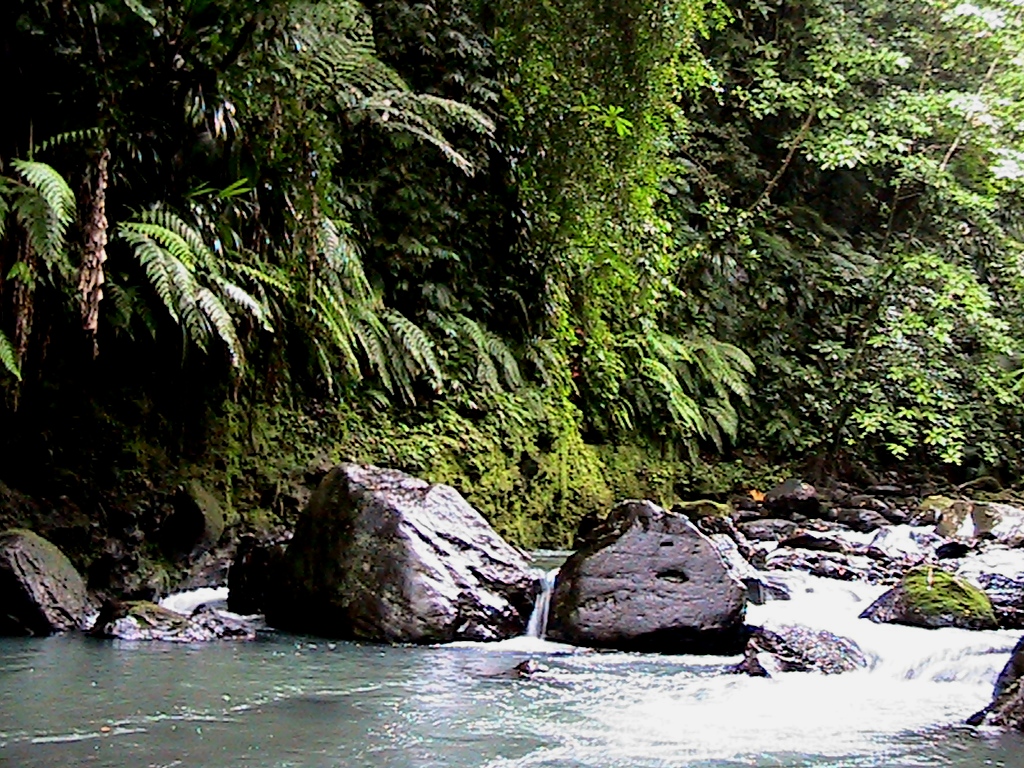
By the trail, there was a tumbling river.


It cascaded over a rock ledge into a pool below. Even on this mainly overcast day, the emerald colour of the pool showed up. Another impressive waterfall on an island with so many.


From here, it took just over an hour to get back to the start of the Trois Pitons trail (starting near the Pont Casse roundabout) on a forest trail over roughly paved rocks and crossing several rivers. This section is part of the Waitukubuli trail which traverses Dominica from south to north.

Reaching the road, I could see that the peaks were covered in dense clouds, but being my last chance to climb the mountain, I went for it.


It was a steep two-hour climb up a well-defined trail through dense forest. Towards the top, ropes helped get up eight-metre high rock faces. And then the final part was a surreal and almost impenetrable world of bogs, thick moss, slippery rock boulders and low contorted branches. 


On the summit, I was enveloped in cold clouds being swept over me at high speed. On a clear day, one would be able to see the entire island and over to Guadeloupe and Martinique, so this would have to remain an excuse for a return trip to the island.  

As I creaked and slipped my way down the mountain, there were infact a few teasing openings in the clouds below, giving me a view of the thick forests of the central part of the island.


Back on the country road again and a couple hundred metres past the roundabout in the direction of the village of Layou, the first house on the right is Harmony Villa.
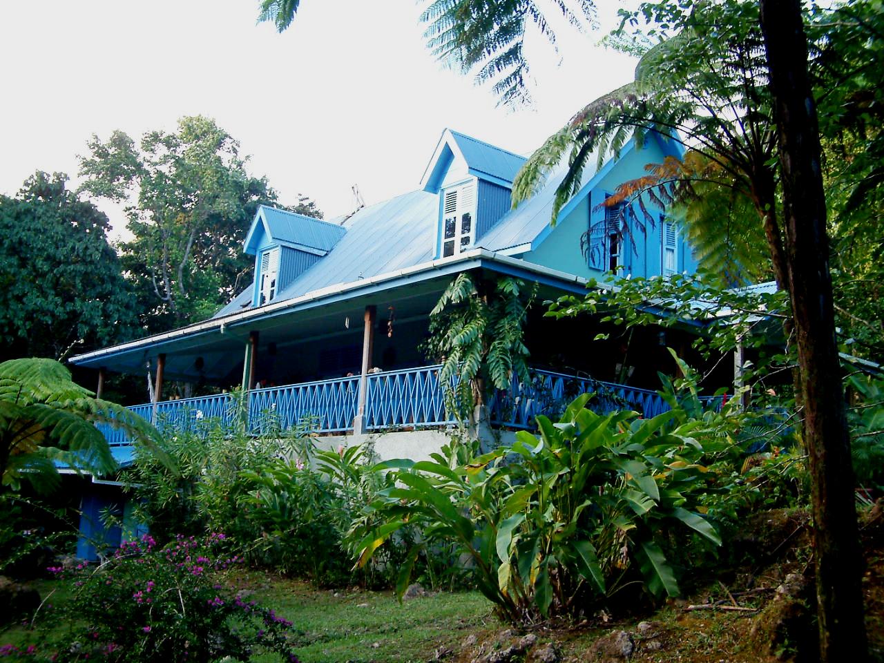

Built in a colonial style, it has large verandas and a cool mountain garden, filled with tree ferns and wild ginger. After a strenous day of walking in the mountains such as today's, I would have a long hot shower, then sit in an armchair on the veranda with a nice big pot of tea.

And, for exploring the island, the location is perfect. Within a hand's throw (or more appropriately, a walk) is Morne Trois Pitons, Emerald Pool and Jacko Falls. Carrying on the Layou road by car or minibus, one would reach the central west coast. Back at the roundabout one road heads to Roseau, the southwest and southeast of the island; another to Rosalie and the Carib Territory on the east coast and another to the northeast and airport. So, it couldn't be more central. 


The spacious interiors give a sense of this being a luxury mountain retreat. From the veranda, there are french doors leading into the villa, with its high cathedral ceiling and central kitchen. Off this, there is an indoor dining area and a lounge with a wood-burning stove. There is also a library, study and studio, used for artists and renewal sessions.

Bedrooms are very comfortable, with large beds and windows which let in plenty of natural light and lend a view onto the two acres of gardens and forest.


Back on the wonderful veranda, there is a large table ideal for al-fresco dining.


Harmony Villa, with its four bedrooms, sleeps eight adults. There are also fold-out and day beds which could sleep up to four children. 

Rates vary from US$250 per night for the use of one bedroom up to US$550 for four bedrooms. For each additional person (after eight), the charge is US$40 per night. Rates exclude the 10% service charge. Minimum stays are two nights. There are discounts for week-long stays.

Further information on www.harmonyvilla.com

Saturday, April 30, 2011

Victoria Falls

Just up from Pointe Mulatre Bay, near the village of Delices, is Victoria Falls.  

The walk starts at the Zion Valley Rastarant (not a spelling mistake).

As I got there, a truck full of friendly rastafarians was leaving. They had just brought back the wreckage of a pickup truck which had gone into a ravine (luckily nobody was injured).


The walk up to Victoria Falls is an interesting one, following the river all the way, and crossing it five times. The river swells shortly after rains, so it's vital to be on alert. When I went up, it was waist deep at the crossings.


I attached myself to a couple from Guadeloupe with a guide who knew the way and where to cross (without a guide, it would be hard to know where to go). Here we are at one point in the river, as we began to approach the falls.


Clambering up river boulders was another feature of this walk. Despite being smooth, rocks were luckily not too slippery.


This is the impressive Victoria Falls. At eighty metres, I could just about fit its whole length into a photo taken from afar.


At its base, the waterfall crashed onto rocks and then a pool. With the people in the foreground, you can see the scale of it (only the bottom quarter of the falls is shown).


The pool was great to swim in, and I really felt the force of the waterfall, as it produced waves and a very strong wind full of water vapour (which stung my face when I swam towards the falls). I clung to the rocks at the side of the falls, but I knew it would be too dangerous to try to swim through the centre, due to the downward force and risk of rocks in the river being brought over the edge.


I decided to head back on my own, thinking it would be easy to retrace our steps. It was OK most of the way, but I did get temporarily lost at one stage during a heavy shower.


I sheltered under a rock for twenty minutes, before finding my way again back to the start.

Thursday, April 21, 2011

Titou Gorge

In the rainforest, just past the entrance to the aerial tramway and on the path leading up to Boiling Lake, I reached Titou Gorge, an incredible natural feature.
Just off the Boiling Lake path, I looked down the narrow gorge to the river fifteen metres below. Not wanting to slip, I grabbed hold of a tree while peering over the edge.


When it's not in flood, you can enter the gorge swimming through a narrow entrance from an open pool area outside. Wanting to photograph it, I went in swimming and holding up my camera with one hand. Being so impressive inside, I thought it was worth the risk of damaging the camera. It looks pitch black inside, but swimming up the river my eyes quickly become accustomed to the light.


The water is fresh and crystal clear and the river is lined by tall vertical rock sides. Looking up, I saw the forest above.


 In places, the sunlight hits the water directly, creating illuminated blue green patches.


And at the end, I got to the rapids.


When the water is low, you can clamber up the side of the rapids and continue up the gorge, something that the canyoning groups do. Camera in hand, I couldn't go up, but got this shot instead. Turn the volume down (the rapid is noisy!).


Titou is before the entrance to the Trois Pitons national park, so entrance is free. In cruise-ship season (November-April) or weekends, if you want the place to yourself, get there before 11 am or after 4 pm. It's a twenty minute walk from the village of Laudat above the Roseau valley, shortly after the aerial tram entrance. It's also a great thing to do on the long trek back from Boiling Lake, soothing those sore legs.

Sunday, March 27, 2011

Trafalgar Falls and thermal streams

One day I caught a minivan bus up to the village of Trafalgar, twenty minutes away and located at an elevation of a few hundred metres.

Within a few minutes of leaving the centre of town, heading into the mountains up Roseau Valley, we were passing through the lush green tropical countryside of Dominica. 

From the last stop in the village, I carried on up past banana and dasheen (taro) plantations.  


Stream water flowing from a hollowed bamboo pipe into a large blue plastic container filled with heliconia flowers.


And a view of geothermal steam rising in columns from thickly forested mountain tops.


At the end of the valley, where the sides of the mountains are compressed into a vertical gorge, lie Trafalgar Falls, plummeting in high volume thirty metres below onto rocks and a natural pool.


Clambering over large boulders, I reached the edge of the pool and was the only person there. 


I went for a swim and opening my eyes underwater, was astounded by the clarity of the water. 

By the base of the falls themselves, I held onto a rock, whilst being pummeled by the falls and then swam underneath, again holding onto rocks underwater due to the current. 

Holding my breath, it was an incredible experience being below the white turbulent water from the falls, descending a metre or so into the clear pool. If you do this, make sure you are a strong swimmer (used to swimming amongst large breaking waves)- currents are strong and could keep you under.


On the way back, I saw a small stream, orangey in colour. 

Wondering if it was thermal, I touched the water, which felt like about 45Âșc. Then I saw steam rise off the far edges by the rocks. 


I couldn't resist the temptation and went for a bathe.


It was the perfect chance for a soak in thermal waters amongst river boulders, surrounded by rainforest- a unique, inspiring and incredibly relaxing experience.

Friday, March 18, 2011

The Essequibo river

Fairview village is just upstream of the Kurupukari crossing over the Essequibo river (Guyana's largest, flowing from the southern highlands to the northern coast). A ferry takes all vehicles across to the other side and provides a link on the main road between Georgetown and Lethem on the Brazilian border.


I took a ride across, to see the forest on the other side. In the foreground is one of the ferry workers.


The cock-pit.


Rapids above the ferry crossing.


Butterflies congregating on a cool and moist sandy beach.


The owner of the house which was being thatched gave me a lift across a bay in the river. He explained that the path around the edge of the forest went through a deep flooded creek, so crossing by canoe was best.


Heading back across the bay to his beach, giving another lift.


Two boys were paddling up the edge of the river and then catching the fast flow below the rapids- a great way to hone their skills for future use.


View of part of the Essequibo river. At this point it divided into several sections, with rapids and islands in between. 


The rapids.


6000 year-old Amerindian petroglyphs on a rock at the rapids, representing animals, people and hunting scenes. These are found all over the Guianan shield and into the Amazon.